Monday, May 31, 2010

Leshan Giant Buddha

One of the things to do when you are in Sichuan province, especially when you are near the vicinity of Chengdu, is to see the Giant Buddha of Leshan.

Leshan is a city located near Chengdu (the provincial capital of Sichuan).  To be honest we weren't very impressed by Chengdu itself where we saw lots of police officers and exiled Russian students with no money trying to find their way back to their country.  Not to worry though, we quickly got out of there and made our way to see the Leshan Giant Buddha!

The Buddha itself is very large, and cannot be seen entirely from land.  This is due to the fact that it is right up against a river.  Because of that, the best views are offered from a boat.

Yes, the Buddha is large and it has been a UNESCO World Heritage Site since 1996.  But we went there, saw the Buddha, and that was pretty much it.  Not much else to see, plus there were TONS of tourists.  So in the end, it was more like a 'been there done that' kind of thing.  Did you notice in the picture my friend Yeonchang standing next to the head?  This gives you an idea of just how giant the Buddha is.  AND the history of this Buddha spans over 1000 years!  I am surprised it is still standing, or sitting to be more accurate.  Of course restoration projects on it have begun, but still it is quite impressive.

To avoid spending lots of money don't eat in the park.  Either bring your own food in or wait until you leave.  I would recommend bringing your own food as the whole affair will take at least half of your day.  To find out more about the Buddha itself read the Wikipedia or Wikitravel article, those links will take you to see more info.

All the information I found about how to get there and what not was provided by the Lonely Planet guide on China which I highly recommend. 

Lonely Planet:  China

Below is the Lonely Planet Guidebook for China.  I would highly recommend this as I often used this as a reference for a wide range of things from finding places to sleep to transportation to eating, and more.  The important thing about traveling in China and most of Asia in general if you are on a budget is to get to know the prices of things.  Guidebooks like Lonely Planet do a pretty good job at telling you approximately what price things should be so that you don't get ripped off.  Click on the image and it will take you to amazon.com where you can purchase your own copy of the book.  

Constipation and Barefootedness

For those of you who have lived in China for a while, you may have heard many weird things related to health.  One of the things I have always heard while living in Shijiazhuang, Hebei province was really off the wall.  It made me think though, if there actually was any scientific basis for it.  After all China has one of the longest histories and medicines on the face of this planet.  I heard it from my host family and from my Chinese teachers.  The problem was when they would see me walk barefooted around the place.  Ok, I know that isn't the smartest thing to do, especially in China, but I am from Hawai'i and we do tend to like to walk barefooted indoors - it's a cultural thing.  Anyway, they would say, "Hey don't walk around barefooted, you're gonna get constipated!"  LOL.

Well it has been a little over two years since I last heard people relate constipation to walking barefoot so I decided to verify their claims once and for all.  My goodness to my surprise I found an article talking about the causes for constipation.  You can read it by clicking here.  In that article it says that parasites can indeed cause constipation and that parasites can be easily picked up by walking barefoot! 

Now I feel a little dumb that I didn't believe my host family and teachers!  However, according to the article you need to walk over an area where an animal that has parasites was sleeping OR where an animal has defecated.  So no worries for my Hawai'i people.  It's not everyday we step in doodoo barefooted. 

Next time I hear some off the wall thing from another country, I won't reject it so quickly.  I should have verified the claims 2 years ago ;)

Friday, May 28, 2010

Haggling With Hags

Ok I admit it, the title of this blog entry is quite harsh.  Let me just be up front about it first though.  I am a tried and true hardcore haggler.  I will negotiate the price of something until I absolutely get the rock bottom price (or until at least I think I got the rock bottom price).  I have been known to spend hours just trying to get the best deal, many times at the expense of my friends saying, "Geez it's just a dollar."  Well let me tell you a dollar can go a long way in many parts of Asia, all my fellow travelers know this.  Anyway, what you see above you is a basket used to carry your toiletries.  I needed one because there was a communal bathroom in my dormitory at Beijing Foreign Studies University.  I haggled to death for this basket... so bad did I haggle that a hag selling the other basket called me a liar and told me to get out of her store. 

*Warning!  Please don't do this to the extent I did.  It is ok to haggle but not when 30 cents or less USD is involved.  Ok everyone is different but that is just me.  It makes a bad ambassador out of you for your respective countries.  I won't do it again for sure.

To make a long story short the hag's basket started off at 15 RMB.  Ok so that is equivalent to a little over 2 USD.  In my opinion you could get something like this at the dollar store, so in my mind I was like, "No ways!"  I told her 5 RMB which is around 73 cents.  She was like, "Haha get outta here that is too cheap."  So she gave the offer of 12 RMB.  I thought hmm, still too expensive, still over a dollar!  I told her I would go next door and figure out what the cost of a similar basket was, she lowered the price to 8 RMB, but I thought it would be worth it to gauge the cost from the other basket.  The man next door gave the same initial offer of 15 RMB.  But through haggling went down to 6 RMB because I gave him the, I'm gonna go next door and find out how much the hag is gonna sell it to me treatment.  I went back to her and told her about what the man next door was offering me.  That is when she said it, "You're a liar, get outta my store, I'm not selling to you."  I went back to the man and bought my basket for 6 RMB! 

Total savings through haggling:  9 RMB ($1.31)

Not bad, but I also may have cost some shame to my fellow Americans.  But hey, I'm Asian by ethnicity so she probably thought I was Korean or Japanese.  So in the end, successful day at haggling, but I felt bad for the hag...  All for a silly basket.

Thursday, May 27, 2010

Hiking Kuli'ou'ou


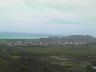
This was the fourth time hiking the Kuli'ou'ou ridge hike.  The hike actually has two options.  Going into the valley or going up to the top of the Ko'olau mountain range.  Most hikers opt for the ridge, as it offers some of the most spectacular views of O'ahu.  On a clear day you can see all the way to diamond head towards town and Mokapu on the Windward side.  The hike gets the most difficult toward the end making it one of the most climactic hikes on the island, with a beautiful view waiting for you right at the end.


The beginning of the hike starts at the end of a culdesac.  A stone sign of the Board of Water Supply will say Kuli'ou'ou 350 Reservoir.  If you see the sign you are in the right place.  Don't go off to the right, but rather walk down the hill.  Going off to the right will lead you to a water tower. 


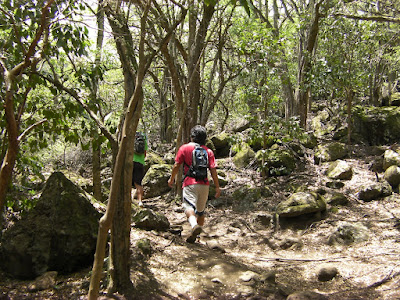
You will quickly enter into a world of trees and rocks.  This part of the hike is very easy, and is really quite a nice stroll in the park.  It is a lot easier than the later parts of the hike.
As you get further in you will come across an intersection in the trail.  If you want to go into the valley keep going straight.  If you want to get to the top of the ridge turn to the right up an incline.  Up that incline you will see a sign telling you to use the trail because not using it will cause erosion.  The trail will quickly become a winding path after this.  Higher up is where you will start to see pine trees like the ones on the left.  These are usually one of my most favorite parts of any hike.  Pine trees seem to keep the place so peaceful. 


Even higher up, you will start to see the Norfolk pines.  These are really a sight to see as many of them are still quite young.  You can tell the bigger ones have been growing for a very long time though already.  In the particular area in the picture on the right, there were many younger pines.  It is a nice refreshing experience to walk through a bunch of adolescant pine trees.


At one point you will come to a clearing with a shack located at the foot of the next incline.  Be sure to take a rest here unless you are really determined to get to the top in a certain amount of time.  After this point, the hike becomes fairly steep and difficult. 


Notice that after the shack, the trees become significantly larger.  They are also predominantly pines.  Watch out for the pine roots sticking out of the ground as they might trip you and become very slippery when wet.  On our way down the hike it rained and the roots became very slippery and dangerous.  Use the pine roots to your advantage by using them as steps when you come to the steep parts. 


The hike will get very steep and there will begin to be man-made steps.  The trail itself is suffering from erosion so I think the steps actually mitigate the rate of erosion.  The hike is climactic because not too far from the photo above, you will instantly come across the photo on the left, letting you see an excellent view of the Windward side.  Too bad the day we went was kinda cloudy.  The view wasn't as good, but I have to admit the coolness factor was still there.


Toward the left at the top facing the Windward side, you will see the Mokulua isalnds  Before the islands on land is Bellows Air Force Station and a bunch of farms in Waimanalo.  


Rabbit island or Manana can be seen toward the right facing the Windward side.  You can see in the picture of Manana on the left that there were many clouds.  I was lucky enough to get this picture off as after I took the picture a bunch of clouds rolled in. 


The top of the ridge is actually very cold as the wind was super strong that day.  Also, if the wind is strong, you will have to close your eyes from time to time to prevent dirt from flying in.  The picture on the right was taken when we just started our descent.  Notice Koko Head Crater on the left and the rest of Hawaii Kai on the right hand side.

View kuli'ou'ou in a larger map


The Kuli'ou'ou Experience
This hike will always be one of my favorites on the island.  You go through so many different types of terrain and I love how the hike is climactic, ending in spectacular fashion.  It seems like you can go further down the Ko'olau mountain range, but I haven't ever done so and wouldn't really recommend it unless you were a pretty good hiker.  We made the mistake of going straight into the valley at first because we missed the section that led you up to the ridge.  We quickly realized this however, and backtracked.  In all, a very nice hike that is hiked best on a clear day.

Hawaiian Language Glossary

Kuli'ou'ou:  Sounding knee (name refers to a small drum that was tied to the knee and played while performing the hula).  "Hawaii Place Names"

Ko'olau:  Short for ko'oko'olau - Windward sides of the Hawaiian Islands.

Waimanalo:  Potable water

Monday, May 24, 2010

Hiking Oneawa Hills


Growing up in Kailua I have always wanted to explore the hill near Kapaa Quarry.  It is an interesting hill dividing Kailua and Kaneohe that offers spectacular views of both sides.  Even though this hike divides Kailua and Kaneohe like the Kalaheo Hill this hill is a lot less dry.  This means you'll see a lot more green and different kinds of plantlife here hiking Oneawa Hills.


We started the hike off of Kokokahi street in Kaneohe.  These stairs are a little difficult to find from the road.  If you are going to hike the ridge to the other side which is supposed to come out at Lipalu Street have somebody drop you off and pick you up on the other side.  Me and my brother Kory had our brother Kurt take us there and our sister Tanya pick us up.  These stairs are supposedly upkept by the surrounding community, and is kept pretty well.  Many of the plants along the trail here are labeled and are pretty diverse.  To find the stairs drive slowly on Kokokahi or get out and walk some when you get near the hill.


The first cool thing we noticed were the bamboo trees.  All of the sudden the trail becomes surrounded by bamboo quite a bit.  The bamboo sort of makes you feel relaxed and zen.  Did you know some bamboo can grow 18 inches per day?
  
Next you will notice different types of plants being labeled and such.  I thought this red hibiscus was worth taking a picture of.  After all it is the state flower of Hawaii.  Originally hibiscus in all colors were considered the Hawaii State flower, however after 1988 the yellow hibiscus was named the state flower.  So I guess technically this isn't the state flower now since it is red.  Did you know yellow hibiscus is the only one native to Hawaii?


I also thought this plant was pretty. It is what I believe to be a heliconia or a parrot flower.  These are pretty much grown for landscaping and don't have use for much else.  Do you know of any way these are used other than for landscapring?


There is a section of the hike that comes to a clearing and you can take a look at Kaneohe Bay.  Here is a picture of Coconut Island and you can even see Chinaman's Hat in the background.  On the very right is a small piece of land.  That is a far corner of Kaneohe Marine Corps Base or the Mokapu Peninsula.


 The scenery of the trail is actually very diverse.  On this section you can see that vines have really taken a stronghold.  Note that the amoung of sticky plants (plants with seeds that stick to your clothes) are PLENTIFUL on this hike.  By the end me and my brother were stickied up.  It seems like less fiborous clothing will do the trick here.  My brother wore a cotton shirt and high socks... not the best combo.


On the ridge you will be able to see both Kaneohe side and Kailua side.  This is the picture of Kawainui Marsh, Kailua Town, and you can see the Mokulua Islands in the background.  The hill you see on the right hand side is actually the hill of the Pillbox Hike


You will come across several clearings of Laua'e ferns. After the ferns, you will be in for a surprise.


I actually didn't really know how this looked up close.  What you see above you is Kapa'a quarry.  They have dug a hole into the ground for the rock.  At the bottom of the hole is a lake.  It is a spectacular sight actually and is the closest thing to the Grand Canyon you will see in Kailua.


Me and my brother, we made a mistake and went off trail.  After seeing the quarry you will come to an area where there are many pink slips indicating for you to make a right turn to head down the hill.  Unfortunately we weren't paying very good attention and ended up doing an hour of trail blazing.  Not fun at the time, but probably the most memorable part of the hike.  We came across lots of pots and dead snails and I thought maybe it was for growing 'special' plants and to protect the 'special' plants snail poison was administered hence the dead snails, but we found no such plants.  We did find what seemed to be an invasive species of plant though.  You can see the seeds of the plant here next to the pink hibiscus.
We backtracked on the trail after we figured out that we were definitely 100% guaranteed going the wrong way.  We went back through California grass, pokey plants, and trees with branches that like to poke you in the eyes.  Finally we came back to the spot where they put lots of pink slips to indicate that you need to go in that direction.  Going down the hill towards Lipalu Street, you will find yourself in fields and fields of these berries.  I don't know what this plant is but it was cool seeing tons of red berries all around you.
Finally toward the end of the trail, tired as heck, we came across this Heiau. I found out that this is the Kawa'ewa'e Heiau and is supposedly where Chief Olopana met his death, slain by Kamapua'a, a demigod.  The Legend of Chief Olopana and Kamapua'a is a very cool story.  You will see that people still make offerings at this Heiau, and it was most likely built for Lono, god of fertility, agriculture, rainfall, and music. 

The Oneawa Hills Experience

Hands down, the most memorable part of this hike was getting lost.  It wasn't fun, but I don't regret it.  We went off the beaten path and saw stuff that the normal people hiking Oneawa Hills don't see.  Remember to keep track of the pink slips.  Also when you get down the hill, try to find your way to the road as soon as possible, unless you want to get to the Heiau.  The trail to the Heiau is marked with orange slips instead of pink.  The hike is worth it but prepare yourself for the sticky plants!


View oneawa hills hike in a larger map

Hawaiian Language Glossary
Oneawa:  Milkfish sand
Kāne'ohe:  Bamboo husband (According to legend, a woman compared her husbands cruelty to the cutting edge of a bamboo knife)  "Hawaii Place Names"
Lipalu:  A type of seaweed
Mokapu:  Sacred district
Laua'e:  A fragrant fern

Sunday, May 23, 2010

Hiking the Kalaheo Hillside


Adventure was the theme of this hike.  I always see the Kalaheo hillside and the famous rock at the top (which the graduating class of Kalaheo High School paints).  But I have never before ventured up there to see what kind of views it had to offer.  The truth is, the views are very nice and what's more, I along with my two brothers discovered a secret up there.  Read more to figure out what kind of secret we found.

 The hike starts off in the corner of the Kalaheo High School parking lot.  You will see a pink strip of plastic indicating where you should enter the fence and from there you will find the trail.  This hike has lots of dry vegetation and can scrape and poke your skin.  Your movement would be a lot more comfortable if you wore jeans and maybe a long sleeve shirt of some sort, but of course you would be less comfortable from the heat.  The short trees can be quite dangerous as they slightly branch out toward the top and may poke you in the face.  So remember to protect your face.


The climb is very dry if there is no rain of course.  The vegetation is dry and the rocks are a little loose.  This along with the trees that irritatingly poke you are the only things that make this hike difficult.  Other than that you will get to the top rather quickly.  Make sure you get a firm footing as you go up as the loose rocks may come out from under you.


If you hike other areas of Kailua like the Pillbox Hike or Olomana, you will notice that there are these rock formations.  I have to ask a geologist why the rock forms like this, I find it very interesting.  Usually it is around the ridges of the mountains.  I am pretty sure it isn't man made, but I couldn't be 100% sure.  Anyone know why?
After you get to the actual rock you will get a very good view of Olomana mountain as you can see on the right hand side of the picture.  You will also see Kailua town (on the left), the dyke that separates Kailua town from Kawainui Marsh, and of course Kawainui Marsh.  Did you know that 4000 years ago the marsh was once an inland sea?  That's how some say Kailua got it's name.  Kailua literally means two seas.  One sea being Kailua bay and the other being where the present Kawainui Marsh is. 


Once you get to the top of the rock area, you will get a very nice view of Kailua Town and the ocean.  Be careful not to venture too close to the rocks edge, it possible you can fall off as the winds are pretty strong up there.  In the picture you can see two of my brothers taking a rest after just getting to the top of the rock. 


My brother Kurt pointed out Kainalu elementary school which you can see in the picture.  When I went there as a kid I didn't realize just how close to the beach it actually is.  Kainalu Elementary School is located at the end of an area in Kailua called coconut grove.  The name is obviously due to the amount of coconut trees growing in the area.  Look how many there are in this picture... tons.


The area is so dry and proof of that can be seen in the type of vegetation you will find.  We found several cactus.  What a nice view of Kawainui Marsh this cactus has.  Sometimes I wonder if I would ever use a cactus as a water source if I ran out of water, which I did that day because my brothers didn't bring water and drank all mine.  I probably would if it were life and death.  You?


This is a close up view of the rock.  The colors of Kalaheo High School are blue and orange.  I don't know what this rock was supposed to represent.  Looked like just splattered paint on the rock.  The tradition of painting the rock on the Kalaheo Hillside was going on for a while.  I don't know if this is actually allowed... probably not.  But as far as I remember it has always been done every year, and I don't see that tradition ending anytime soon.


The rock is not located at the top of the hill.  You will have to climb a little more to get to the top.  After you get to the top you can go right or left, as there is a trail that follows the ridge line of the hillside.  I would suggest going to the right (heading towards Aikahi).  Me and my brother Kory went to the left and had to trail blaze eventually.  If you do go to the left watch out for barbed wire.  It tends to be sorta hidden in the vegetation.  In the background is a view of Kaneohe Bay. 


SURPRISE!  We didn't even know it existed.  You will get to this location if you decide to turn a right after you get to the top of the hill above the rock.  This is a full blown elaborate bike park.  It looks like a bunch of people took shovels, hammers, wood, and nails and built the thing with their bare hands.  It was the coolest thing running through the trails of the bike park with my brothers.  Some of the ramps though seemed quite scary.  I wouldn't mind bringing a mountain bike out here and trying some of the trails though. 


View kalaheo hillside hike in a larger map


Notice how whoever built the bike park did a good job of making these makeshift bridges.  We all walked across and it seemed to be sturdy.


The Kalaheo Hillside Hike Experience

This hike was really fun as it offered outstanding views of Kailua and Kaneohe and had the bike park surprise.  Next time I come I think I'll bring a bike on down and try some of the trails.  You will notice that people really put a lot of effort into making this park. I hope you'll get a chance to experience the Kalaheo Hillside for yourself.


Hawaiian Language Glossary


Kawainui:  Big water
Kainalu:  Ocean wave

Thursday, May 20, 2010

Chuanzhusi 川主寺: The Friendly Town


Welcome to a place where time seems to stand still.  Where the traditions of culture still thrive and people struggle to earn a living, all the while maintaining ultra-friendly personalities.  This is Chuanzhusi.  Chuanzhusi is located in Songpan County Sichuan Province.  It is a town at the crossroads between Jiuzhaigou and Huanglong.  I can confidently say that this was the friendliest Chinese town that I have ever visited.  Friendly in the more family/caring sense.  The people are still competing for your business, which will cause them to try to make prices higher than they should be, yet stay competitive.  We bargained on everything, including food!  Just because it was so darn expensive, we felt compelled to do it.  It is quite encouraging when you can bargain better than the local nationals.  That is what we were told by two visitors we met traveling from Hangzhou.  We quickly made friends with them as they were a very young couple and quickly took fancy to our immature jokes.

Upon arrival to Chuanzhusi, we quickly noticed that the town was rather empty.  Apparently it wasn't the peak season to travel to Jiuzhaigou and Huanglong and there were lots of empty rooms throughout the whole town.  These are absolutely perfect conditions to use your bargaining skills.  We went from motel to motel asking if they had hot water and what price they were offering per night.  Eventually we chopped the price from 100 RMB per night to 30 RMB per night!  That was where we bargained for our food too.  The food was so delicious, and unfortunately I was so hungry that in my ravenous ferver, I forgot to take photos of our sweet-sour fish (糖醋鱼) and Huiguo rou (回锅肉).  The Chinese couple were stunned at our bargaining skills and kept talking about it.  This strengthened my notion of Chinese culture putting heavy value on finding and obtaining the good sale.  Besides we were traveling on a shoestring and it's not like my Korean travelmates had unlimited resources.
The surrounding town does not have much in the sightseeing category, but we did manage to get to a Buddhist temple.  The temple we looked at seemed old and not kept as well.  This was delightful as most temples in China seem to be kept for tourism, this one did not have that jive to it.  Monks were walking around on the temple grounds and it felt authentic.  Being fairly close to Tibet and so high up in altitude made me think that this was the closest thing to a Tibetan town that I might come across, if I ever make it out to Tibet of course, which I intend to one day.  The ethnic minority is apparently the Qiangzu (羌族).  Women apparently act as the head of the family, and that seemed to be actively practiced in Chuanzhusi.  All business owners or at least the transactions were done with women.  Talking to the locals was quite fun.  I think they were probably very interested in us, as we were strange yet could speak Mandarin so we had the ability to discuss the differences we had.    You could tell they were authentic too.  They had real families to support who seemed to be doing ok, as I saw many children playing towards the end of the day.  Although for the most part the town seemed to be authentically Qiang, there was evidence of tourism which was expected.  The town makes much of its money off of tourists passing by.  We came across a tacky dance class that reminded me of hula lessons given to tourists at lu'aus back home in Hawai'i.  Of course this dance was not hula, but a dance of the Qiang people, which consisted of walking around in group circles, similar to Japanese Obon.     

The Chuanzhusi Experience

I was really refreshed after my stay at Chuanzhusi.  Our time in Songpan county with Jiuzhaigou and Huanglong was coming to an end and Chuanzhusi was an excellent way to close it off.  We finally got to see the culture of the 'real' people that live in the area.  Luckily we had the toursists from Hangzhou to do a little comparison.  The Qiang as well as the tourists were both Chinese by nationality yet our tourists from Hangzhou knew just as much about the Qiang as an American and 3 South Koreans.  Staying at Chuanzhusi will give you a mix of peace, relaxation, and a heckuva warm atmosphere in a rather cold place.  We only stayed one night, but I wanted to stay more.  I hope I can go back one day.


Banner at Chuanzhusi Temple

Notice the type of material used to build this structure which was next to the temple we went to visit.  Looks like clay on dried grass.  Supposedly it works very well as an insulator.

The buildings of this town aren't that impressive, but the scenery of the surrounding mountains make up for it.

Sorry about this blurry pic but I wanted to show the local beer next to the shop owner who sold it to us.  The beer wasn't quite to my taste.  Reminded me of caramel added to rum and coke with a little less rum.

Lonely Planet:  China

Below is the Lonely Planet Guidebook for China.  I would highly recommend this as I often used this as a reference for a wide range of things from finding places to sleep to transportation to eating, and more.  The important thing about traveling in China and most of Asia in general if you are on a budget is to get to know the prices of things.  Guidebooks like Lonely Planet do a pretty good job at telling you approximately what price things should be so that you don't get ripped off.  Click on the image and it will take you to amazon.com where you can purchase your own copy of the book.